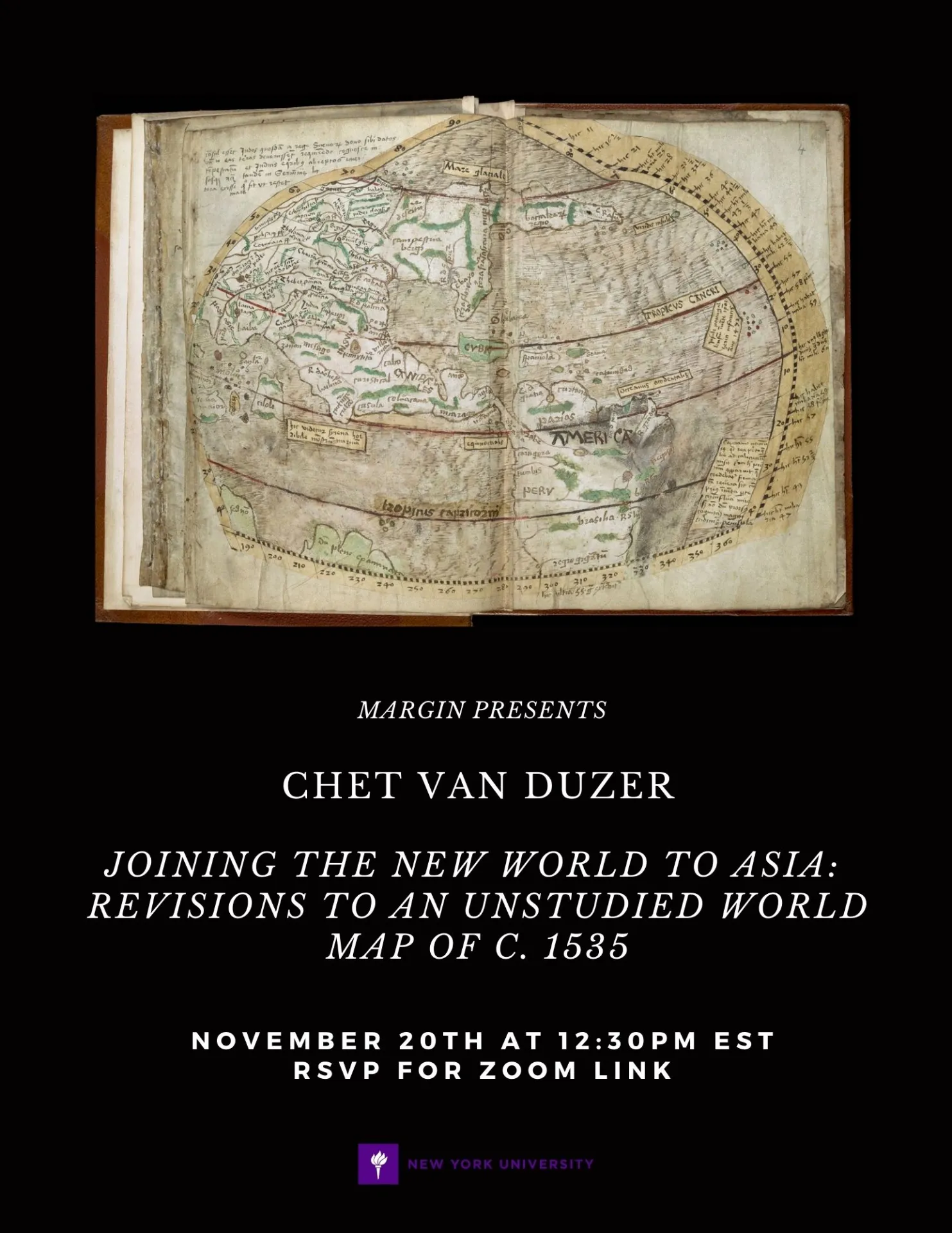
“British Library, Sloane MS 117, ff. 1r-4r contains a manuscript world map in two hemispheres that has been dated to about 1530 and has been mentioned in the cartographic literature several times, but never properly studied. The most remarkable feature of the map are the revisions in the hemisphere devoted to the New World, which can be seen in multispectral images of these folios. Originally the map showed the New World as separate from Asia, but it was changed to show the New World as being connected to Asia. The map thus vividly demonstrates the difficulty Europeans faced in interpreting the new discoveries in the West, and in deciding what the relationship was between those discoveries and Asia—this confusion dates back to Christopher Columbus, of course, who thought that the lands he encountered after crossing the Atlantic were in Asia.
It has not been previously noted that the two hemispheres, prior to the revisions, were based on the inset hemispheric maps at the top of Martin Waldseemüller’s 1507 world map: not only are they visually similar to Waldseemüller’s inset maps, but some of the texts on the hemispheric maps were copied from elsewhere on the 1507 map. It seems likely that the hemispheric maps were produced in the workshop of the Swiss humanist Henricus Glareanus (1488-1563), as their visual style is similar to that of Glareanus’s other maps, and Glareanus made multiple manuscript copies of Waldseemüller’s maps. Justin Windsor and Henry Harrisse had suggested that the details of the revised New World map were copied from Oronce Fine’s 1530 world map, but in fact, they were copied from Fine’s 1534 world map, as is demonstrated by some texts and place names on the map.”
Chet van Duzer studies historic maps from the Middle Ages and Renaissance into the nineteenth century, with an emphasis on determining the sources that cartographers used for the texts, images, and geographical features in their works. One part of his work has been to study damaged maps by recovering information from them using multispectral imaging. He is a Board Member of the Lazarus Project at the University of Rochester, which provides low-cost access to multispectral imaging to institutions and researchers around the world. See http://www.lazarusprojectimaging.com/
His most recent publication is titled Martin Waldseemüller’s Carta Marina of 1516: Study and Transcription of the Long Legends (New York: Springer, 2020).